


An original and beautiful trail starting from a unique historic site!
This tour is only available during the Fort l'Ecluse opening season.
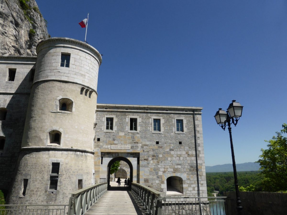
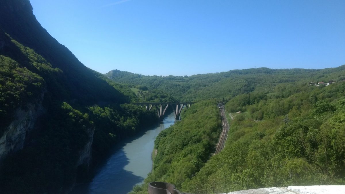
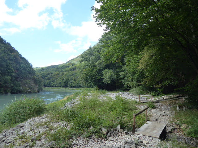
The walk starts in the lower courtyard of the fort. Leave the fort through the "Porte de Genève" gate and continue along the banks of the Rhône (right bank). The ascent to "Le Lavoux", crossing the railway line, leads to the ruins of the "Moulins de Condière": in medieval times, under the authority of the Count of Savoy, a small industry used the hydraulic power of the "nans" and "biefs". For centuries, a tramway was used to cross the Rhône at this point.
The climb up to the village of Léaz is through undergrowth. Discover the charm of this authentic village! Crossing the departmental road takes you to the heights of Léaz, offering bucolic landscapes through meadows. After "aux Marais", a pretty descent takes you to the Hauts de Longeray. A final climb up to the upper fort guarantees a panoramic view. Finally, follow the path to the lower fort, then cross the road to reach the fort parking lot.
Please note that the first part of the route is only possible when the Fort is open, otherwise go directly to Lavoux.
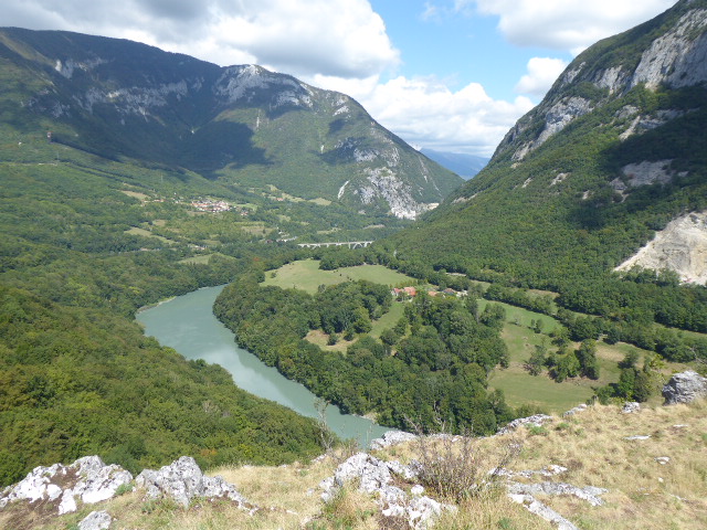
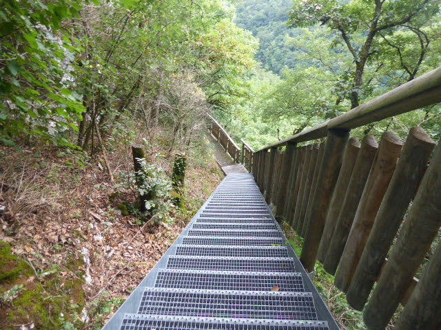
Guidebook with maps/step-by-step: From the parking lot (A), enter the Fort, cross the lower courtyard and exit through the "de Genève" gate. Turn right (B) onto a narrow path winding through the forest, then pass a metal staircase. Follow a wider path which bends to the right, and descend a ramp near a railway tunnel (C). Reach a road on the left, follow it to the right, then take a path along the Rhône (D). Pass a series of footbridges and climb up to Lavoux (E); (from here, you can shorten the walk and reach the parking lot by the road on the right). Turn left onto a small road, cross the railroad line and reach the "Moulins de Condière" (F). Follow the Rhône river up to Léaz (G) along a winding path. Cross the village, use the safe passage (H) then follow the signs for "Aux Marais" (I). From here, continue straight ahead on a path through meadows, then descend towards Haut de Longeray (J). Climb towards the upper Fort. From Les Binsets (K), a round trip (200m) is required to discover the panoramic view (L) over the Rhône Cluse, Vuache and Etournel. From "Les Binsets", descend to the Lower Fort. Take extra care when crossing the road near the Fort tunnel (M), upstream from the parking lot.
More information:
Before setting off:- Find out about general and local weather conditions, making sure there's no precipitation.- Find out about the approach to the route, its height, how long it will take to reach the summit and any possible escapes (IGN map, GPS, topo-guide, etc.).- Evaluate possible risks by asking mountain professionals, refuges and gîtes.- Inform someone close to you of your objective, and contact them again in the event of any changes: departure and return times, number of participants with telephone numbers for each, vehicle(s), parking, etc.- Avoid setting off alone, and use equipment that is suitable for the activity, adjusted and in good condition: headlamp, complete first-aid kit, survival blanket, etc.In the event of a problem, call 112 (European emergency number).
Itinerary
In detail
- Distance: 12 km
- Markup: BALISE
- Elevation gain : 720 m
- Negative elevation gain : 544 m
- Daily duration: 300 min
- Type of route: BOUCLE
- Beaconing accuracy: From the parking lot (A), enter the Fort, cross the lower courtyard and exit through the "de Genève" gate. Turn right (B) onto a narrow path winding through the forest, then pass a metal staircase. Follow a wider path which bends to the right, and descend a ramp near a railway tunnel (C). Reach a road on the left, follow it to the right, then take a path along the Rhône (D). Pass a series of footbridges and climb up to Lavoux (E); (from here, you can shorten the walk and reach the parking lot by the road on the right). Turn left onto a small road, cross the railroad line and reach the "Moulins de Condière" (F). Follow the Rhône river up to Léaz (G) along a winding path. Cross the village, use the safe passage (H) then follow the signs for "Aux Marais" (I). From here, continue straight ahead on a path through meadows, then descend towards Haut de Longeray (J). Climb towards the upper Fort. From Les Binsets (K), a round trip (200m) is required to discover the panoramic view (L) over the Rhône Cluse, Vuache and Etournel. From "Les Binsets", descend to the Lower Fort. Take extra care when crossing the road near the Fort tunnel (M), upstream from the parking lot.
- Nature of the land: Rock
- Nature of the land: Ground
- Nature of the land: Grit
- Nature of the land: Not suitable for strollers
Opening
From 01/04 to 30/11.
Rates
Free access.
Facilities & services
Facilities
- Car park
- Free car park
Services
- Pets welcome
- Pets supplement
Host language(s)
- French
