


A very easy circuit that takes you to discover Mont Mourex and its panorama, the pasture and the forest made up of oak, chestnut, beech, maple, fir and spruce trees... Can be done with children who are already mountain bikers.
This loop can be completed from 2 different starting points: either from the Mont Mussy forest road, or from Mont Mourex.
The route described here starts from the Mont Mussy parking lot.
A very easy route to discover Mont Mourex and its panoramic views, the hedged farmland and the forest of oak, chestnut, beech, maple, fir and spruce.
At the start of the route: the mountain bike signs indicate 80 routes, most of which are shared (route no. 80 green + route no. 81 blue).
Warning: this loop is quite busy, both for pedestrians and mountain bikers. Be careful with other riders (mountain bikers and/or pedestrians with many dogs) you meet (children, families).
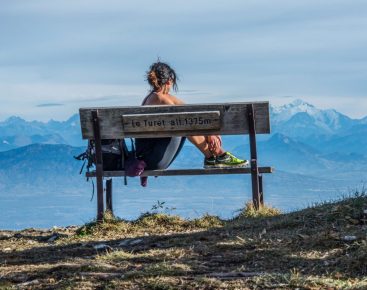
Guidebook with maps/step-by-step: From the Mont Mussy parking lot, take the path beside the hiking information points. Under the wood, the path veers slightly to the right. Follow the mountain bike signposts (square plaques) on the trees. The section under the wood towards Mont Mourex is slightly uphill. The exit from the wood is marked by a barbed-wire fence with a mountain-bike crossing, then a track and a grassy path.On the open section, follow the path, always in the same direction. Before descending, don't miss the orientation table facing the Alps, bordered by a wooden fence, 200 m to the left of the path (from the orientation table, take a short detour to see the monolith and bench of Mont Mourex).Then: down the hill. At the sign next to the grey building (reservoir), turn left onto the flat path leading back the other way. (towards Divonne). Enter the forest again, and follow signposting no.80, which will take you back to Mont Mussy, at the trailhead.
More information:
Mountain biking the way you want it! but... For your own safety, use the marked trails and respect the direction of travel.Don't overestimate your abilities and keep your speed under control.Be careful and courteous when overtaking or crossing paths with other hikers, as pedestrians have priority.Check that your mountain bike is in good condition, and bring supplies and repair accessories with you.If you're going on your own, leave your itinerary to those around you.Wearing a helmet is strongly recommendedRespect private property and cultivated areasWatch out for farm and forestry machinery Close gatesAvoid picking wild flowers, fruit and mushroomsDo not disturb wild animalsKeep your garbage to yourself, be discreet and respectful of the environment.
Itinerary
In detail
- Distance: 5 km
- Markup: BALISE
- Elevation gain : 94 m
- Negative elevation gain : 94 m
- Daily duration: 45 min
- Type of route: BOUCLE
- Beaconing accuracy: Follow the green bicycle signs n°80
- Tricky passage: Mountain biking the way you want it! but... For your own safety, use the marked trails and respect the direction of travel.Don't overestimate your abilities and keep your speed under control.Be careful and courteous when overtaking or crossing paths with other hikers, as pedestrians have priority.Check that your mountain bike is in good condition, and bring supplies and repair accessories with you.If you're going on your own, leave your itinerary to those around you.Wearing a helmet is strongly recommendedRespect private property and cultivated areasWatch out for farm and forestry machinery Close gatesAvoid picking wild flowers, fruit and mushroomsDo not disturb wild animalsKeep your litter, be discreet and respectful of the environment
- Nature of the land: Ground
Facilities & services
Facilities
- Car park
Services
- Pets welcome
