



GR® 9 from Mijoux to Culoz
Starting from Saint-Amour (39), the GR® 9 links the Jura massif to the Gulf of Saint-Tropez. It crosses the east of the Ain département from north to south over around 100 km, between ridges, plateaux and valleys.
▶ Day 1: Mijoux → Refuge de la Loge
Distance: 13.8 km Elevation gain: 899 m / Elevation loss: 451 m Route: Follow the GR trail (red and white markers): Mijoux, through the village toward La Faucille, Grand Mont Rond, Colomby de Gex, Col de Crozet, and Refuge de la Loge.
▶ Day 2: Refuge de la Loge → Refuge de la Poutouille Distance: 15.5 km Elevation gain: 681 m / Elevation loss: 666 m – Route: Follow the GR: Refuge de la Loge, Brillone d’en Haut, Combe des Voyettes, Sous le Crêt, Crêt de la Neige, Reculet, La Plovette, Pierre de la Lune, Le Gralet, Couloir du Ladet, and La Poutouille.
▶Day 3: La Poutouille → Lancrans Distance: 17.1 km Elevation gain: 614 m / Elevation loss: 1,575 m Route: Follow the GR: La Poutouille, La Pelaz, La Grange Velue, Col de Menthières, Menthières, La Charnaz, La Pierre à Fromage, Crêt de la Goutte, Sorgia d’en Haut, Sorgia d’en Bas, Métral, and Lancrans.
▶Day 4: Lancrans → La Charnay Distance: 16.5 km Elevation gain: 994 m / Elevation loss: 222 m Route: Follow the GR: Lancrans, Perte de la Valserine, Pont de Métral, Parking des Berges, Bellegarde-sur-Valserine, Rue Lafayette, Rond-Point aux Portes de l’Ain, Rue de Mussel, Route de l’Ochiaz, Ochiaz, Catray d’en Bas, Catray, Pra Devant, and La Charnay.
▶Day 5: La Charnay → Arvières Distance: 21.1 km Elevation gain: 537 m / Elevation loss: 619 m Route: Follow the GR: La Charnay, Le Tumet, Crêt du Nu, Croix des Terments, Planvanel, Golet Grand-Voie, Col de Richemond, Refuge de la Grange d’en Haut, La Grange d’en Bas, Grange de Falavier, Chalet d’Arvières.
▶Day 6: Arvières → Culoz Distance: 19.9 km Elevation gain: 484 m / Elevation loss: 1,424 m Route: Follow the GR trail: Arvières, Sapin Daubré, Col de Charbemènes, Croix du Grand Colombier, Grand Colombier, Grange à Masse, Les Granges Neuves, Le Fenestrez, Romagneux, Hauteur de Culoz, Culoz, and Pont de la Loi.
Itinerary details
Description
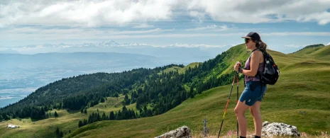
The GR® 9 enters the Ain département via Mijoux, before following the spectacular ridges of the Monts-Jura, passing the Crêt de la Neige, the highest point in the massif. It then descends towards Bellegarde-sur-Valserine, crossing the Retord plateau and crossing the Grand Colombier. The trail continues as far as Culoz and the Rhône valley, before leaving the Ain and heading south into Savoie.
The route runs through the heart of the Haut-Jura Regional Nature Park, and part of the Haute Chaîne du Jura National Nature Reserve: a protected, unspoilt area to be explored with respect.
Good to know – Protected area
Part of the route passes through the Haute Chaîne du Jura National Nature Reserve, which is subject to special regulations:
Dogs are not allowed, even on a lead.
Camping in tents prohibited.
Please respect these rules to preserve the richness of this exceptional environment.