


(1) From Place de l'Eglise, follow the yellow signs (PR) and turn right into Rue Brian Stresemann for around 100 metres. Turn left into rue de la Vierge and follow it up to the fourth street on the left: rue Mollard. Follow this street to its end, then turn right into rue du Quart. Take the second street on the left, Rue des Fergots, and follow it to the end. This is the Chemin des Écoliers. Follow this straight ahead, then turn right into rue du Mont. A few metres further on, turn left into rue du Reculet, then immediately right to continue.
(2) The path rises gently through the forest, with a gradual change in altitude of 250 metres over just over a kilometre. It leads to the Tiocan chalet, a well-known landmark in the area.
(3) Turn right onto the Route du Reculet for around 800 metres. A path climbs up on the left. After 200 metres, keep left. The path crosses the first stream, then continues right to join the white chemin de la Croisée. Follow this to the right for around twenty metres, then turn immediately left to continue up the hill. The path crosses a second stream before reaching a new intersection.
(4) At this junction, turn left towards the Chalet de Narderans. Just before you reach it, fork right to climb the rock faces known as the Narderans vaults. The view is superb, but the climb is steep. Continue along this path for around 1.2 km until you reach the GR near the summit of Le Reculet.
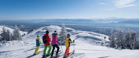
(5) Le Reculet, the highest point at 1718 metres, is a good place to stop. Continue on the GR down the other side towards Crêt de la Neige. The terrain becomes undulating: the path starts wide, then a small track descends to the left, skirting the remains of an old hamlet, and gradually climbs back up. You cross an area of hooked pines, then the path becomes steeper as you approach the summit, with views of the Crêt de la Neige canyons.
(6) At Crêt de la Neige (1720 m), the highest point in the Jura, enjoy the panoramic view. To continue, follow the GR signposted ‘Sous le Crêt’. About 100 m further on, turn right onto a yellow-marked path leading to Curson. It quickly descends, winding its way between the rocks to reach the Chalet du Curson.
(7) Pass between the chalet and the cistern to find a wide white path heading towards Thoiry-devant. At the reservoir, take the path on the right, which more or less follows the contour line until it forks again. Follow the path to the right: 500 m further on is the chalet at Thoiry-devant.(8) Continue downhill on the white path that runs alongside the cisterns, then joins a ridge before descending through the woods. A little further on, the path reconnects with the La Croisée junction.
(9) Follow the outward path in the opposite direction back to the known junctions. There is a small alternative route that takes you more quickly to the Tiocan chalet. From Le Tiocan, follow the same route as the outward journey back to the starting point.
Itinerary details
Description
The route takes you through the heart of the Haut-Jura Regional Nature Park, and part of the Haute Chaîne du Jura National Nature Reserve: a protected, unspoilt area to be explored with respect.
Good to know – Protected area
Part of the route passes through the Haute Chaîne du Jura National Nature Reserve, which is subject to special regulations:
Dogs are not allowed, even on a lead.
Please respect these rules to preserve the richness of this exceptional environment.