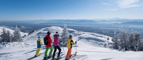


Hiking: the high peaks from Lélex
This tour offers a varied and demanding route from the banks of the Valserine to the highest peaks of the Jura. A sublime panorama of the Alps, Lake Geneva and the Jura mountains awaits hikers in an unspoilt setting.
Itinerary details
Alert
The 32 contours path, which climbs from Le Plat des Menues to Le Reculet, is demanding. Better to take it on the way up rather than on the way down.
After the Crêt de la Neige, the GR path that follows the ridges is winding: be careful where you step.
Description
Valserine river at the bottom of the valley and passes through its peat bog. Remarkable flora grows here in fine weather. The entrance to the nature reserve is reached before beginning the ascent of the Jura Mountains and Reculet (1,719 m). A 1,600 kg cross was hoisted there in 1892 by four inhabitants of Thoiry. The trail continues to Crêt de la Neige, the highest point of the massif at 1,720 m. Before descending to the village of Lélex, note the remains of ancient buildings along the trail, which bear witness to human activity in the Jura Mountains and its alpine farming tradition.
The route takes you through the heart of the Haut-Jura Regional Nature Park, and part of the Haute Chaîne du Jura National Nature Reserve: a protected, unspoilt area to be explored with respect.
Good to know – Protected area
Part of the route passes through the Haute Chaîne du Jura National Nature Reserve, which is subject to special regulations:
Dogs are not allowed, even on a lead.
Please respect these rules to preserve the richness of this exceptional environment.
You are passing through a wildlife quiet zone in the Crêt de la Neige area; use of the GR trail is tolerated during the closure period, provided you stay strictly on the marked path.
Your itinerary
Step 1: The Tourist Office
From the tourist office, follow the yellow signs, then turn left towards La Vieille Chapelle. The two one-way roads converge at this intersection, whether you come from the upper or lower road. After passing several shops, continue until the road becomes two-way again, then take the second road on the right.
Step 2: La Vielle Chapelle
From here, follow the GR® (red and white markings) down the Route du Frênet. Pass to the left of the Chapelon farm, the Chalet Louis Marchand, then the tennis courts, before reaching the Pont de la Fruitière.
Step 3: Le Pont de la Frutière
Just after crossing the Valserine, turn left towards Le Niaizet. The first part of the route is on a road which then becomes a white path after passing under a fir stand. Walk past a house and a peat bog, then continue to the end of the combe, where you'll see an intersection with a bench.
Step 4: Le Niaizet
Turn left off the GR® and continue on the yellow PR to cross the Pont du Niaizet.
Step 5: Le Pont du Niaizet
Just after the bridge, take the path on the right. It briefly skirts the stream before gradually climbing up to reach the main road.
Step 6: Plat des Menues
Cross the road to the median opposite. This is where the Chemin des 32 Contours begins. A monolith stands on the left beside an information panel. Follow the signs for Le Reculet. From this point on, the climb becomes more demanding: the path narrows to become a winding path through the trees. In less than 3 km and 700 m of ascent, we reach a new junction after emerging from the forest into the high alpine pastures. A superb view of the Valserine and Crêt de Chalam is revealed.
Step 7: Thoiry Derrière
At Thoiry Derrière, continue climbing towards the Croix du Reculet, clearly visible from this point. The last few metres of ascent are made to the sound of clarines. The path skirts around the back of a stone hut, quickly rejoins the ridge and rejoins the GR®. Turn right towards Le Reculet (1,719 m), the second-highest summit in the Jura massif.
Step 8: Reculet

Enjoy the breathtaking panoramic view. Follow the same path for about 200 m, then continue along the ridge towards Crêt de la Neige. The path begins as a wide track, which soon becomes a narrower path. The ruins of an old alpine village appear on the left. The path then turns right and begins the ascent to the highest point of the Jura massif, skirting hooked pines.
Step 9: Crêt de la Neige
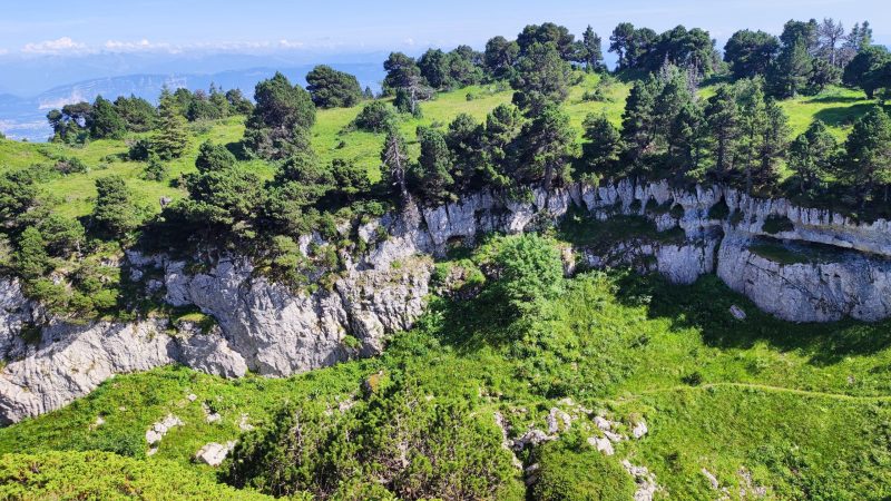
The Crêt de la Neige (1,720 m) dominates the Lake Geneva basin and the Valserine valley. Enjoy the landscape marked by cavities, faults and canyons, evidence of an eventful geology. Continue along the ridge, following an undulating profile. The path becomes steeper, but its natural continuity leads to the next junction.
Step 10: Under the Crêt
At the Sous le Crêt junction, the descent to Lélex begins. Still on the GR®, the first few hundred metres are steep. Then the path skirts a cirque, crosses a pretty combe, and begins another steady descent through undergrowth. It opens out into the Combe des Voyettes, then passes to the left of a ruin before arriving on a white track at Les Brillones d'en Haut.
Step 11: Brillones from Above
Leave the GR® and turn left towards Brulats-Frésy on a yellow path. The first few hundred metres are easy, but a path descending to the right soon enters a quiet area. It winds through the trees and descends rapidly to the next crossing point.
Step 12: Brulats Frèsy
At the Chalet du Ratou intersection, rejoin the GR® and continue downhill to the left. This is where the slope becomes steepest. The route alternates between white paths and footpaths, crosses the green Fieret downhill ski run twice, and arrives at the first Lélex pastures.
Step 13: Chalet du Ratou
Continue towards the village, reaching the first houses. To return to the tourist office, turn right.