


Hiking: La Catheline – le Crêt de la Neige via Brulat Frésy
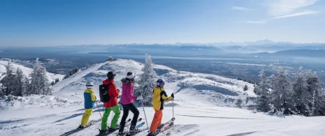
The trail follows the ridges, allowing you to fully appreciate the exceptional geology and flora of the mountain range. Once you have reached the Crêt de la Neige, the highest point in the Jura, a spectacular view awaits you.
Itinerary details
Alert
Be sure to follow the GR9 signs, to avoid passing through the Quiet Zonewhich is strictly prohibited from 15/12 to 30/06.
The route is located in the Haute Chaîne du Jura National Nature Reserve, so please respect the regulations specific to this area.
Description
From the upper station of the Catheline gondola (during the summer), the trail passes through a variety of landscapes: spruce forests, alpine meadows and rocky ridges, bordered by remarkable flora. If you're lucky, you may catch a glimpse of chamois on the steep slopes. The ascent offers exceptional views of the Geneva basin, Lake Geneva and the Alps, dominated by Mont Blanc. Arrivingl at the highest point of the summit ridge at 1720m rewards hikers with an exceptional view. On the descent you will come across ancient mountain pastures and their remains, bearing witness to centuries-old local pastoral activity.
Your itinerary
Step 1: Catheline cable car
From the upper station of the Catheline gondola, turn right along the GR (red and white markings) towards the Chalet de la Loge. For around 400 metres, the path descends slightly until it joins a wide white track that runs alongside the chalet.
Step 2: Lodge Chalet
Continue on this white track for just over 400 metres. It is hilly and crosses a ski slope in the forest. At La Brillonne d'en Haut, take the path on the left. This enters a combe and begins to climb more steeply, passing by a ruin, then through undergrowth, before reaching another combe at the next intersection.
Step 3: Voyettes Valley
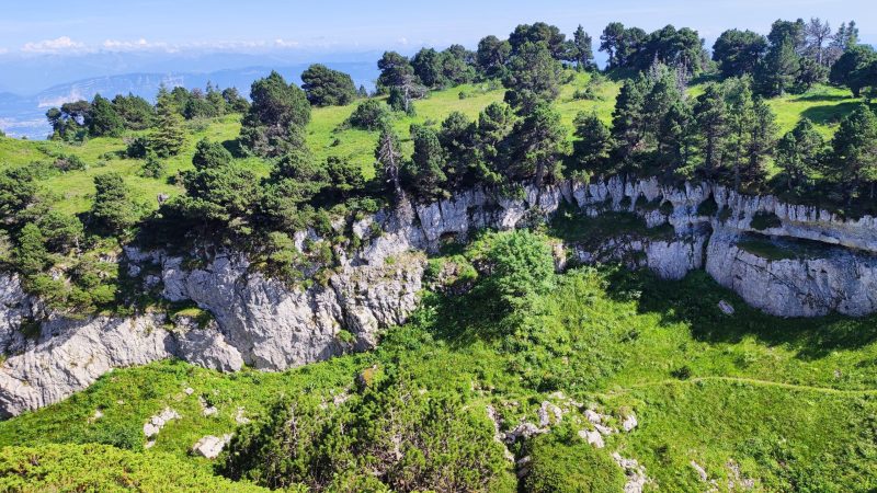
At the Combe des Voyettes, the path climbs, skirting the reservoir on the left. It quickly gains altitude, then returns to the forest, leaving the woods at Brulat Frésy. Keep to the left and keep climbing: the path skirts a small circus full of scree before finishing its ascent on the ridge.
Step 4: Under the Crêt
nce you have reached the Crêt, the most demanding part is behind you. The panorama is already opening up over the Lake Geneva basin, the Alps and Mont Blanc. After the turnstile, turn right and stay on the GR towards Crêt de la Neige. The path becomes winding and hilly, offering fine views over the canyons of the Crêt de la Neige before a final short climb to the summit.
Step 5: Crêt de la Neige
The Crêt de la Neige is the highest point in the Jura (1,720 m) and blends into the ridge and is not always visible from further away. The ridge line with its ancient mountain pine trees offers a breathtaking view of Le Reculet, Mont Blanc and the Valserine valley. This is a contemplative place to take a break. The return by the same route.