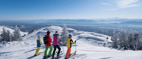


Hiking: in the footsteps of the smugglers
This hike for experienced walkers leads to majestic peaks steeped in history. A true immersion in unspoilt wilderness, via ancient hidden paths…
Itinerary details
Description
A demanding hike between deep forests and verdant alpine pastures, following in the footsteps of smugglers who, in the 18th century, used these discreet paths to transport their clandestine goods. Departing from Chézery-Forens, the route follows the wild Valserine river, before beginning the ascent to Le Reculet, culminating at 1719m. Capped by its famous cross, erected in 1892, this summit offers breathtaking views of the Lake Geneva basin and Mont Blanc on a clear day. The descent to the alpine chalets (La Polvette and La Capitaine) leads to the Passage des Chézerands and the hamlet of Rosset.
The Reculet cross, weighing 1600 kg, was carried to the summit on the backs of four Thoiry residents.
Good to know – Protected area
Part of the route passes through the Haute Chaîne du Jura National Nature Reserve, which is subject to special regulations:
Dogs are not allowed, even on a lead.
Please respect these rules to preserve the richness of this exceptional environment.
Your itinerary
Step 1: Chézery-Forens Town Hall
From Chézery-Forens, follow the yellow signs along the main street. Pass the gendarmerie, go straight on, then leave the village and head upstream. The path winds through a pretty combe before reaching the first intersection on the right.
Step 2: Fontaine Benite
Continue as far as Fontaine Benite, then take the path that gradually rises towards Les Platelets, before reaching the peaceful hamlet of Rivière.
Step 3: Village of the River
Cross the main road and start climbing towards Le Vernay.
Step 4: Pont Népalais
On the way, a bridge spans the Troubléry stream. After crossing the stream, continue uphill as the path becomes more deeply entrenched in nature.
Step 5: Vernay du Dessus
At Vernay du Dessus, turn left around the house. The narrower path winds through the forest, crossing several times a white track leading to Chalet de Lachat.
Step 6: Chalet de Lachat
Shortly afterwards, Chalet de Lachat appears below. Ignore the descent and continue left towards Le Reculet. You then reach the edge of the forest, where the high alpine pastures open up beneath you. The view opens up over the Haut Jura with the Crêt de Chalam in the background. Continue up to the next junction.
Step 7: Thoiry de Derrière
A few more steps and the Chalet de Thoiry comes into view accompanied by the Reculet cross. Continue for several hundred metres to reach the highest point of the hike: Le Reculet (1718 m).
Step 8: Croix du Reculet
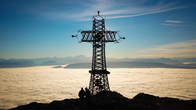
The summit offers a 360° panoramic view: to the south, Geneva, the Lake Geneva basin, the Alps and the spectacular Mont Blanc; to the west, the Jura massif, Crêt de Chalam, Crêt aux Merles and the Valserine valley. From the crossroads turn right and follow the ridge south along the GR (red and white markings). The landscape is grandiose, punctuated by the sound of bells.
Step 9: The Plovette Alpine Pasture
Cross the Plovette and Capitaine mountain pastures and skirt the Roche Franche. The path oscillates between gentle ascents and descents.
Step 10: Les Avalanches
The ridge continues for a while before plunging into the forest. The path crosses several attractive combes and reaches the Chézerands pass, just before the Gralet chalet.
Step 11: The Moonstone
Turn right and begin the descent into the valley. The yellow markings reappear to guide to the end of the route.
Step 12: Le Gralet
The path winds through the woods crossing the forest road several times. The descent is rapid to the village of Le Rosset.
Step 13: Hamlet of Rosset
Cross the hamlet and continue to the right. The path skirts a field, bordered by a hedge, before joining an alsphalt road. Continue along this road.
Step 14: Grande Bossonaz
At the first intersection, turn left onto a white track. Pass the Grande Bossonaz farm, then follow the path along the field to Bellaigue.
Step 15: Bellaigue
Finally, turn right and stay on the white track which leads straight back to Chézery-Forens.