


Cycling route: the Pays de Gex Grand Cycle Race
The Grande Cyclo sportive du Pays de Gex is an exceptional route between the Jura Mountains and the Valserine Valley, featuring a succession of long climbs, challenging passes and technical descents in a wild, unspoilt setting.
These road bike itineraries are for guidance only, and are aimed exclusively at experienced cyclists.
Important information before you set off:
▶These routes are not marked on the ground and require the use of a GPS or navigation app.
▶The routes use roads open to motorized traffic. Compliance with the Highway Code is mandatory.
▶These routes are recommended for experienced cyclists in good physical condition who have mastered the art of road biking.
▶We advise you to check weather conditions before setting off and adapt your outing accordingly.
Start / Finish: Lélex
Km 0 — Start
North access road, then join the D991.
Km 0 to 8.5 — D991 (8.2 km)
Gradual climb toward the Jura Mountains.
Km 8.5 to 19.1 — D936 then D292 (Route du Manon)
Steady climb, gradually gaining elevation.
Km 19.1 to 31.3 — Molunes → Moussières → La Pesse section
Hilly terrain followed by an uphill stretch. Challenging terrain.
Km 31.3 to 44.5 — Combe d’Evuaz (11 km)
⚠️ Long technical descent toward the Valserine Valley.
Km 44.5 to 64.9 — Haut-Bugey (D48, D33, D55)
Series of climbs, rugged and isolated terrain. Constant effort.
Mile 64.9 to 81.8 — Secondary roads (D55a, D48)
Irregular profile, alternating climbs and descents.
Mile 81.8 to 89.5 — Return to the Valserine Valley (D14a then D991)
Relatively easy, rolling section for recovery.
Km 97.8 to 106 — Col de Menthières (8.1 km)
⚠️ Major final climb of the route. Sustained effort at the end of the ride.
Km 106 to 120 — Return to the Pays de Gex (D991)
Final rolling kilometers with accumulated fatigue.
Km 120 — Finish 🏁
Itinerary details
Alert
A road shared with motorists.
Description
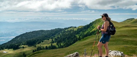
This route is designed for well-trained cyclists and offers a complete immersion in the landscapes of the Haut-Jura and Haut-Bugey, featuring a succession of long climbs, isolated stretches and technical descents.
The route starts from Lélex in the Pays de Gex with a gradual climb towards the Monts Jura via the D991, before reaching the high-altitude areas of Les Molunes and Les Moussières. This first section allows you to gain altitude gradually, in a forest environment typical of the massif.
The route then turns towards La Pesse, before plunging into the Valserine valley via the spectacular Combe d’Evuaz road. After this long descent, the route becomes wilder and more challenging, taking in several secondary roads in the Haut-Bugey, with a succession of demanding climbs and false flats.
The second major challenge comes at the end of the route with the ascent of the Col de Menthières, a sustained climb that brings the day’s effort to a close before the return to the Pays de Gex.
This route stands out for its intensity, its isolation on certain sections and the variety of its landscapes, ranging from Jura ridges to steep-sided valleys and forest roads.
This route is provided for guidance only and is intended exclusively for experienced cyclists of a very high standard.
▶▶Important information before you set out:
This route is not marked and requires the use of a GPS. Some sections are remote, with few places to restock supplies. The route follows roads open to traffic, which are sometimes narrow and winding. Excellent physical fitness is essential. Check the weather forecast, especially at higher elevations.