


Cycling route: The Northern Gesse Loop
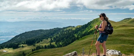
The Northern Gex Loop sets off from Gex, passing through Sergy, Saint-Genis-Pouilly, Versonnex and Cessy before reaching Divonne-les-Bains. A hilly route winding through the villages of the Gex region, offering panoramic views of Lake Geneva
These road bike itineraries are for guidance only, and are aimed exclusively at experienced cyclists.
Important information before you set off:
▶These routes are not marked on the ground and require the use of a GPS or navigation app.
▶The routes use roads open to motorized traffic. Compliance with the Highway Code is mandatory.
▶These routes are recommended for experienced cyclists in good physical condition who have mastered the art of road biking.
▶We advise you to check weather conditions before setting off and adapt your outing accordingly.
Km 0 — Start in Gex (669 m)
Take the western access road for 12 m, turn left and follow the A642 for 29 m.
Km 0.7 — Turn left, still on the A642 (642 m)
Continue for 662 m. Descent from Gex towards the plain.
Km 1.2 — Turn right towards Place Perdtemps, then left towards Rue de la Fontaine (598 m)
Cross the centre of Gex for 394 m.
Km 2.0 — Turn right towards Rue Leone de Joinville (638 m)
Continue for 799 m. The descent continues.
Km 2.9 — Keep left towards Rue de l’Etraz (635 m)
Follow for 884 m.
Km 4.9 — Straight on towards Rue de Vallière (615 m)
Long straight stretch of 2.03 km. Rolling terrain towards Sergy.
Km 5.1 — Turn left onto Route de la Vie-Dessus, then turn left onto Rue de la Pierre (598 m)
Continue for 204 m.
Km 5.2 — Turn right onto Rue des Saugis (602 m)
Continue for 120 m.
Km 5.4 — Turn left onto Rue des Maures (591 m)
Continue for 162 m.
Km 5.5 — Turn right onto a road, then keep left towards Route de Naz Dessus (592 m)
Continue for 79 m. Sergy area.
Km 6.9 — Turn left onto Route de la Source, then turn right onto Route du Pont de l’Allondon, D89 (563 m)
⚠️ Follow the D89 for 2.18 km. A beautiful road running alongside the Allondon.
Km 9.0 — Turn left onto Route d’Harée (539 m)
Follow for 847 m.
Km 10.9 — Keep right, still on Route d’Harée (491 m)
Several junctions close together; stay on Route d’Harée for about 800 m.
Km 11.7 — Continue straight on towards Route de Crozet (470 m)
Follow the road for 203 m, then keep right for 90 m.
Km 12.0 — Keep right onto the D35a (467 m)
Follow the road for 30 m. Saint-Genis-Pouilly area. Lowest point of the route.
Km 13.1 — Towards Saint-Genis-Pouilly (455 m)
A long, rolling stretch of nearly 6 km across the Gessian plain.
Km 18.8 — Straight on towards Rue de Villard, D78d (474 m)
Follow for 50 m.
Km 18.9 — Turn left onto Rue de Gex, D1005 (480 m)
Follow for 339 m. Pass through Saint-Genis-Pouilly.
Km 19.2 — Turn right onto Rue de Divonne, D15 (484 m)
⚠️ Busier road. Follow the D15 for 402 m.
Km 19.6 — Keep right, still on the D15 (484 m)
Continue for 94 m then straight on for 1.34 km towards Versonnex and Cessy.
Km 22.8 — Keep right towards Route de Versonnex, D15 (507 m)
Follow for 104 m. Pass through Versonnex.
Km 25.2 — Turn right onto Chemin Jacques Belay (513 m)
Follow for 185 m.
Km 25.4 — Turn left onto the cycle path (513 m)
⚠️ Follow the cycle path for 2.42 km. A pleasant and safe stretch towards Cessy.
Km 27.6 — Turn left onto Avenue du Mont Mussy, D15 (482 m)
Follow for 160 m. Approaching Divonne-les-Bains.
Km 28.8 — Keep right onto Avenue du Mont Mussy, D984c (519 m)
Follow for 30 m.
Km 30.2 — Turn right onto Route de Saint-Gix (564 m)
Follow for 687 m. Crossing the hills above Divonne-les-Bains.
Km 32.1 — Keep left towards Chemin de l’Etraz (664 m)
Continue for 1.85 km. ⚠️ Start of the final climb towards Gex.
Km 32.7 — Slightly right towards Route de Divonne, D15h, then turn right onto Route de la Chapelle (668 m)
Turn around immediately, follow Route de la Chapelle for 2.68 km. ⚠️ Steep climb towards Gex.
Km 35.4 — Turn right towards Rue des Usiniers (600 m)
Follow for 736 m.
Km 36.1 — Keep left towards Rue du Creux du Loup (630 m)
Follow for 380 m.
Km 36.5 — Turn right onto Chemin des Clavières d’Englane (660 m)
Turn around immediately and backtrack for 34 m.
Km 36.6 — Turn right onto Rue du Creux du Loup (660 m)
Follow for 531 m.
Km 37.1 — Keep left onto Rue de Paris, D1005 (723 m)
Follow for 159 m. ⚠️ Highest point of the route.
Km 37.3 — Turn right onto Impasse des Contreforts (737 m) 🏔️
Follow for 388 m then keep left for 50 m.
Km 37.7 — Turn right onto Rue de Paris, D1005 (729 m)
Final straight of 670 m, gentle descent towards Gex.
Km 38.4 — Finish in Gex (669 m) 🏁
Itinerary details
Alert
A road shared with motorists.
Description
This route takes you on a beautiful loop starting in Gex. It first descends toward the Gex plain, passing through Sergy and Saint-Genis-Pouilly, before following the Swiss border towards Versonnex and Cessy. It then reaches Divonne-les-Bains, a spa town on the shores of Lake Geneva, before beginning the return journey via the Route de la Chapelle. The end of the route offers a beautiful final climb with unobstructed views of the plain and the Alps, before returning to Gex. A challenging route, combining technical descents, fast-paced sections and sustained climbs in a remarkable natural setting.
▶▶This road cycling route is provided for guidance only and is intended exclusively for experienced cyclists.
Important information before you set off:
This route is not signposted and requires the use of a GPS or navigation app. The route uses roads open to motor traffic: compliance with the Highway Code is mandatory. A good level of fitness and proficiency in road cycling are essential. Please also remember to check the weather conditions before setting off and adapt your ride accordingly.