


Faulty beaconing, safety incidents, conflicts of use, illegal dumping? Locate and share the problem you have encountered on the national alert system via the SURICATE app or the https://sentinelles.sportsdenature.fr/ website.
(1) Start from the Route de la Greffière, which links the RN5 to the center of the La Faucille resort. Rejoin the RN5, cross it carefully, then continue in the direction of Gex.
(2) The path starts on the left, just opposite the Hôtel La Couronne. It begins a gradual climb before becoming gentle hills. You then enter the Turet forest, where the path winds peacefully through the trees. Along the way, you pass spectacular geological formations that bear witness to the massif’s turbulent past. The path then joins the route forestière de la Vieille Maison. Follow this track to the right to reach the Chalet forestier du Turet.
(3) The trail resumes just after the chalet, on the right of the road. A slight climb leads to another crossing of the forest track, before entering a pretty, shady combe. Here, at an intersection, you can choose between the Mauvais Pas path, which leads down to Gex, or the Turet path.
(4) Keep to the right, towards Le Turet. The path enters a pretty area of undergrowth lined with low stone walls. As you leave the forest, a small ridge comes into view: walk past the small stone cross that stands on it then begin the descent.
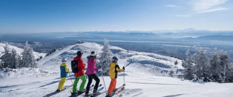
(5) The view soon opens up giving way to an imposing 180° panorama. A well-placed bench invites you to take a contemplative break: your gaze takes in the crests of the Jura, the plain below and on a clear day the peaks of the Alps in the distance.
The return journey is a leisurely one along the same path.
Itinerary details
Alert
Description
The route takes in the heart of the Haut-Jura Regional Nature Park, and part of the Haute Chaîne du Jura National Nature Reserve: a protected, unspoilt area to be explored with respect.
Good to know – Protected area
Part of the route passes through the Haute Chaîne du Jura National Nature Reserve, which is subject to special regulations:
Dogs are not allowed, even on a lead.
Please respect these rules to preserve the richness of this exceptional environment.